3. Douglas Lake Trail (day use)
Distance: 10.2 miles (additional miles possible via adjacent sloughs and creeks)
Start: Upper Bryant Landing (private; public use fee associated)
End: Upper Bryant Landing (private; public use fee associated)
Type of trail: creek, lake, and slough
Habitats: bottomland hardwood swamp, flowing creeks, side channel sloughs and backwaters
Reliability: excellent
Optimal water levels: Claiborne Dam river stages ranging from 6 to 19 feet on tailrace reading provide optimum water levels for this route. For water level information at Claiborne Dam, call 1-888-771-4601.
The Douglas Lake day trail begins at Upper Bryant Landing, located north of Stockton, AL, on Baldwin County road 21. The map shows the trail leaving Upper Bryant Landing proceeding upstream on Tensaw Lake, into Douglas Lake to the end of the channel. The return leg follows the same route. Paddlers have several options for selecting the length and duration of this day-trip.
Category Archives: Uncategorized
Journey Through the Locks of Time Part III: Robert F Henry Lock and Dam to Ft Toulouse
Robert F. Henry Lock and Dam
Upriver just over a mile above Benton Park, the final upper impoundment on the Alabama River is held in place against the Robert F. Henry Lock and Dam. In doing so it creates the Robert E. “Bob” Woodruff Lake. Two parks at the dam, East Bank and West Bank, serve the public and boaters.
The banks are steep enough in this part of the river that lock operation and water level control by the dam do not appreciably change the width of the river.
As for fishing, bass thrive here because of their opportunity to stuff themselves with shad. The river is home to a lot of crappie, which make for great fishing early in the year. Hybrid striped bass, white bass, channel cat, blue and flathead catfish are to be found in quantity below the dam, where they may be fished from bank or boat. A fishing deck has been constructed on each bank near the dam.
Prairie Creek Campground
Two miles towards Montgomery from the Robert F. Henry Lock & Dam is Prairie Creek Campground, one of the finest on the river. Prairie Creek is a haven for the paddler and powerboater. Its proximity to the wide, quiet backwaters of Prairie Creek (not to mention the low, gentle banks and their easy access to land) make it a great place to paddle.
The concrete aprons at the campground will accommodate all your serious toys, but the campsites are designed to befriend the modest camper as well. The double-loop at Prairie Creek gives you the option of creek-side or river-side campsites, many with wooden decks extending near or over the water. Trees hung with Spanish moss are everywhere at Prairie Creek, enhancing the privacy of each site and the beauty of this gem upon the river.
Naturalist Nugget: In a tight bend where Brown’s Branch comes into the river, is stunning House Bluff, a steep earth wall showing hundreds of layers of geological deposits. House Bluff is, geologically speaking, the southernmost tip of the Appalachian Mountains.
Holy Ground Battlefield Park
Holy Ground Battlefield Park, where the U.S. Army Corps of Engineers operates a day-use park with all the amenities the river traveler might want other than fuel and food, features a boat launch, pavilions (with interpretive signage) and foot trails can be found there.
Holy Ground Battlefield is a place of immense, if sad, historical significance. The massacre of white settlers by Indians further down the Alabama at Fort Mims sent shockwaves of fear through the state’s fledgling settlements, and both whites and Indians were using reprisals and counter-reprisals to spread hatred and garner support for their own causes. Reeling from the sharp reprisals and simultaneously stirred up by British agents who saw any trouble in the Alabama frontier as a way to divert the country’s military away from the main fronts in the War of 1812, leaders of the Indians’ pro-war Red Stick faction gathered fighters and families alike at Holy Ground. They convinced their followers that with their feet on this soil, the white man’s bullets would have no effect on them. The cost of that folly was enormous to the Indians who took refuge here. Their leader, William Weatherford, the last Indian to retreat, is said to have made a daring escape from the battle by leaping from the riverbank and swimming the river mounted on his horse, Arrow, with his rifle held over his head and with bullets splattering the water around him.
Naturalist Nugget: This stretch of the river, down to Selma and many miles beyond, is a particularly pleasant and scenic stretch for the boater. The sinuous path of the river alternates between low banks and high bluffs, some of them quite breathtaking. Multiple American bald eagles can be seen here simultaneously; one or more great blue herons seem to dominate every turn in the river’s course; and numerous anhinga and ducks can be seen in a single outing. Spanish moss creates an atmosphere of comfortable gloom as the river rolls past and through which the calls of busy waterfowl and shorebirds are heard.
At mile 253.2, a few miles below Autaugaville and two miles above Holy Ground Battlefield Park lies the Union steamboat Autaugi. The Autaugi went down in 1865 with the bodies of dead soldiers that had been reclaimed from the Confederate prison camp at Cahaba for their final journey home after the end of the war.
Montgomery RiverWalk
Adjacent to Union Station, on a place once called Hostile Bluff by early Alabama settlers, is Montgomery’s excellent RiverWalk. The park was built between the river and the mouth of the old tunnel where horses once drew cotton and cargo between the city’s docks and Coosa Street. The sprawling park is s combination of almost every activity the city has to offer. The city’s active public amphitheater is located here as is a large splashpad water park for children to enjoy on hot days. RiverWalk Stadium is home to the Southern League’s Montgomery Biscuits. This minor league ballpark opened in 2004 and hosts up to 7,000 visitors a night. Standing adjacent to the RiverWalk is Union Station, built in 1898 and once served the city with forty-four trains per day. Today, Union Station houses the city’s main visitor’s center and gift shop.
A short walk from your landing at RiverWalk will bring you to the doors of the Station. Inside you will find a wealth of information about what to see and do in Montgomery, and you will find a gift shop filled with souvenirs and remembrances as well as important historical information. Even better, a walk out the front door will take you to the city’s tourist trolley system. It stops at many attractions along its two fixed routes. Each trolley rounds one route, returns to the Union Station, and then goes on the next route. Along the route, you can signal a stop. The pick-up points are at major attractions along the route.
The City of Montgomery
From the river, the RiverWalk includes the white, tent like amphitheater on the left bank. A dock below the amphitheater provides shore access and presents a series of steps up to an area of grassy lawn and ancient brickwork, and the mouth of a tunnel. This tunnel is the remains of the old freight slide where stevedores hauled cotton and other goods between the decks of visiting steamboats and the cobblestones of Commerce Street. Up the slide, now a walking path beneath the railroad tracks, and a turn to the right is Union Station, a Montgomery landmark that once was the terminus of rail traffic into the city. Today, Union Station serves as offices, gift shop, a tourism information point for all of downtown and the area, and a Thai restaurant. The inside of the station is the best place to pick up information about sights and entertainment. The front of the station is the place to step onto a trolley and make your way around town on a historic tour of the city.
A brief self-guided walking tour of Montgomery is a great way to get your land legs back and immerse yourself in an unforgettable afternoon of adventure. Leaving the RiverWalk up the old freight tunnel will put you into sunlight on Commerce Street with Union Station to your right. The Visitors Center on the building’s ground floor will provide you with virtually everything to know about the city. From there, proceed to the Rosa Parks museum. The next few blocks to the roundabout at Court Square should be done with one eye out for the easy-going traffic in the area and the other eye upon the architectural details overhead. At Court Square, Commerce Street turns left to become Dexter Avenue and the view up the hill aims at the state’s Greek revival capitol.
A block before the capitol is the Dexter Avenue Baptist Church where the Reverend Martin Luther King pondered and then acted out his part in the nation’s civil rights struggle that at the time centered upon the Alabama capital. One block uphill to the right from the church and across the street from each other stand the old and the new buildings of the Southern Poverty Law Center. It was here that the remnants of power held in the 1990s by the Ku Klux Klan were finally stripped away. Its slanting concrete ramparts, laid as a deterrent to potential truck bombs, evidence the new, much larger building. Across the street at the old Center, the Civil Rights Memorial and its stunning memorial fountain (designed by Maya Lin, who also designed the Vietnam Veterans Memorial), whose flat, black surface sheds water along its circumference, whose edge is a timeline of the grievous loss of forty victims of that struggle.
Just two blocks east of the Southern Poverty Law Center and one block downhill toward the Capitol is the First White House of the Confederacy, home of Confederate President Jefferson Davis while the capital of the Confederacy was located in Montgomery. The building now houses many items of historical interest.
Walking back to the RiverWalk and Union Station area is St. John’s Episcopal Church (on Madison Street at it intersects with Perry Street). Within the spacious and beautiful old church are found its comfortable wooden pews—comfortable all except for one, whose straight back and bottom are not contoured, as are the others, to fit the human form. This was the pew of Confederate president Jefferson Davis, respect for whom has left the original to resist attempts to modernize it. The church’s magnificent stained glass windows were created in the studios of Louis Comfort Tiffany.
Back in our powerboat, canoe or kayak, your tour of Montgomery returns to the water and you leave Montgomery where the Marquis de Lafayette left it in 1825 and head as he did toward Selma.
On the left bank of the next north-bound stretch of the river, where Maxwell Air Force Base now lies, is the site selected by aviator brothers Wilbur and Orville Wright for the nation’s first commercial aviation training school. The history of the area is interwoven with the history of flight since its inception after the turn of the 20th century, and nearby Tuskegee is known as the home of the brave airmen who were, in World War Two, the first black aviators to train to defend their country.
Swift Creek Park
Though not having the amenities of some other parks, Swift Creek Park in Autaugaville is a very popular launch on Woodruff Lake.
Gunter Hill Campground
Gunter Hill Campground is probably the best of the US Army Corps of Engineers Campgrounds along the Alabama River, and that’s saying something. Isaac Creek, Millers Ferry and Prairie Bluff campgrounds are outstanding places not only for their amenities, but for the lands and waters they are situated upon as well. But Gunter Hill, just a half-hour drive from downtown Montgomery, has recently undergone a very expensive facelift. The campground, now as charming as it is functional, is located on Catoma Creek and possesses every amenity to support fishing, children’s play, picnicking, boating and camping in anything from a tent to the largest RV.
Catoma Creek was the birthplace of David Moniac, who was the first “mixed-race” graduate of West Point in the class of 1822. He died in the Seminole War of 1836.
561 Booth Rd, Montgomery, Alabama 36108
GPS: 32.358648, -86.452431
Local Directions: From I-65, take Exit 167 onto US 80 west for 9 miles. Turn right on County Road 7. Follow signs into the campground
334 269 1053
Cooters Pond
Cooters Pond, a generous lake connecting the town of Prattville with the Alabama River, has numerous picnic sites, a hiking trail, an overlook, a ballpark, large pavilions, and a boat launch. The park may also be used as an overnight paddler’s campsite. Fishing, boating and camping information for R. E. “Bob” Woodward Lake is available from the Prattville Chamber of Commerce at 800 588 2796.
Powder Magazine Park
Rounding the bend into the bluffs over the river in Montgomery, Powder Magazine Park sits on the bank near the downtown part of the city. A boat ramp provides river access with plenty of parking for boat trailers and vehicles. A shelter provides an opportunity for a picnic under the stand of mature trees that covers the park.
Montgomery Marina
At mile 288 on the Alabama River the Montgomery Marina is situated. Renowned for decades under the operation of the salty Captain Pat Dozier, who knew the Alabama River like few others, the Marina served as Montgomery’s only access to the river. Until the city’s RiverWalk was created, the business of recreation was centered upon the Marina and to a large extent this is true today.
The Marina was recently purchased by Lewis Mashburn, owner of the legendary Capitol Oyster Bar, which deserved its reputation as the meeting place of the best blues music and the best seafood in Montgomery. Mashburn moved his venue to the Marina and adapted the building into another successful music and food venue. The Marina is still the main recreational connection with the Alabama River, but is also the place to spend a happy afternoon or evening with a great view of the water. The best blues artists from all over the US can be heard at the Marina’s stage.
617 Shady Street, Montgomery, 36104. 334 239 8958. www.capitoloysterbar.com.
Fort Toulouse Historical Site
Fort Toulouse is located where the Coosa and Tallapoosa Rivers join to form the Alabama River.
Some of the most sweeping events in our nation’s history turned on the fortunes of the soldiers, traders and Indians of Fort Toulouse. The French established the fort in 1717 on a narrow bluff separating the Coosa and Tallapoosa rivers.
The site had been used as a campsite for archaic hunters some 5,000 years before. Sometime after AD 1200, a palisaded Mississippian town with three ceremonial town was built here as part of the mound-builders culture.
The Creek Indians called the place “Franca choka chula,” or Old French Trading House. The English reached the forks of the Alabama by 1690, but the fort kept them from establishing a foothold.
Transportation to reach civilization was not easy. For the French, Mobile was reached by boats rowed by Indians 357 miles to the south, a distance that took seven days to achieve (an average of 51 miles per day). The Fort was 425 long miles from Charles Town (Charleston) by packhorse.
The French abandoned the Fort in 1763 as the French relinquished their holdings in the region. It was to be rebuilt in 1814 as Ft Jackson when Andrew Jackson was sent into Alabama to prosecute the Creek Wars, the Indians’ loss of which ended with their loss of lands and expulsion on the Trail of Tears.
During the American operation of the Fort, such notables as Andrew Jackson; Chief Red Eagle; and the creator of our national anthem Francis Scott Key walked its grounds.
The ramparts of Ft Jackson exist today, as does a functional replica of the French Fort at what is now known as the Fort Toulouse-Fort Jackson State Historic Site. Open year-round, visitors can step back in time through realistically recreated French and American encampments. Almost every month includes a weekend of living military history as well as daily living. The park features a 39-site campground with full hookups and a bathhouse. Each November, the Fort brings history to life during weeklong Frontier Days during which thousands of visitors mingle with authentic citizens of long ago.
For more information about visiting, camping or attending events at the fort, call 334 567 3002.
Access, Parks and Campground along the Alabama River
Rules and regulations
Most of the facilities mentioned in this article and shown on the attending map are on properties operated by the US Army Corps of Engineers. A link to their Rules and Regulations follows. Consult the Contact Information provided for Rules and Regulations of other properties you might visit:
http://corpslakes.usace.army.mil/employees/visitassist/pdfs/title36-lrl.pdf
Universal Access Policies
It is the policy of the U.S. Army Corps of Engineers to provide universally accessible recreation opportunities for all people. The Corps will ensure that all new and existing facilities and programs meet or exceed current guidelines. Some existing facilities are continuing to be retro-fitted as funding allows.
Journey through the Locks of Time on the Alabama River Part II: Millers Ferry Lock and Dam to Robert F Henry Lock and Dam
Above: The Alabama River showing the access and camping facilities between Millers Ferry Lock and Dam and Robert F Henry Lock and Dam are shown here. A larger map for planning and printing can be downloaded by clicking on the images above.
Millers Ferry Lock and Dam
At River Mile 122, less than a mile below the Lee Long Bridge, is Millers Ferry Dam. To access the lock, stay to the right of the long pointed peninsula and stay left into the lock. The locks don’t operate around the clock or even every day of the week anymore. Call ahead to 334 682 4877 with your expected lock time. If your trip doesn’t coincide with the lock’s shift operation, and you are in a paddleboat, then a marked portage on the west bank is available to you. Obey the signs for where you can and can’t go and don’t cut corners or circumvent fences—you could be in violation of homeland security restrictions.
Gees Bend Ferry
The modern Gees Bend Ferry provides a water connection along County Road 28. This ferry provides the only direct route to the Boykin community and the people of Gees Bend, once living in obscure poverty, but today famous for the art of their quilting. Traveling the channel from this terminal is the Camden side landing. The southern terminus is about three miles from the water on Highway 28.
There is plenty of river here for the boater and the ferry, which runs eight times a day the year around. If you’re in a powerboat, be sure to keep an eye on the depth if you are out of the channel. Watch for the ferry markers and you’ll be OK.
A legacy of hardship on Gees Bend
Many “benders” are the descendents of slaves who had once worked the land here and almost perished during the Great Depression. Since the days following the Civil War, benders had worked the land and had been quietly cared for by the landowners’ business partners. When the price of cotton plummeted during the depression, the crops they grew no longer paid for their food, seed and utensils and their presence showed up in the financial books as a great surprise. When the absentee landlords discovered their presence here, they booted them from their homes at gunpoint, leaving them literally to starve to death. The former tenants would certainly have died during the terrible winter that followed had it not been for the kindness of neighboring farmers, the Red Cross, and the newly-established New Deal programs that delivered financial aid here in this desperate, remote bend of the Alabama.
Gees Bend Area Day trip highlights
Several day trips are available in this area for the adventurous powerboater or paddler willing to stay on top of navigation and keep and eye out for river traffic, which includes the Gees Bend ferry and its wide swings to stay between channel markers.
If you’re camping at Roland Cooper State Park or Millers Ferry Campground, paddling the environs of the river from either place will provide an afternoon of exploration. Millers Ferry Campground actually has shared and individual campsite access to the water, and both campgrounds have boat ramps.
The same short trip is available by launching from Millers Ferry Marina.
A visit with the famous Gees Bend quilters
After their economic salvation in the wake of the Great Depression, the people of Gees Bend lived relatively quiet lives in their crook of the river. During the 1940s, 1950s and 1960s, the women of the bend would gather to quilt. The quilts they were produced were of their own style and were unique to Gees Bend. The artistic idiom they worked in owed nothing to anything that neither they nor anyone else had ever seen. If anything, their quilt patterns resembled the abstract expressionist art that was taking shape in a world far away from Gees Bend during that time—something the bender women had virtually no way of knowing and no incentive to incorporate into traditional quilting even if they had.
When the work of these extraordinary women was discovered and popularized by the outside “art world” in the 1980s, it caused a sensation. The quilts were suddenly seen in museums and galleries around the world. Their works have been cataloged in important books on American art. The quilts of Gees Bend suddenly commanded astronomical prices, especially compared with any way of earning a living the women had known before, and they continue to provide this tight-knit group of creators the work they desire. The artistic fame made these women into national treasures. It brought a modicum of wealth to the bend, and it was appreciated.
If you’re in the Gees Bend area and want to see the famous quilters at work, you’ll want to take the ferry if driving. From the nearby town of Camden, take Highway 41 out of town and turn left on Highway 10. Look for County Road 28 north of town, and then take Ellis Landing Road at the Gees Bend Ferry sign in sight of the big silos.
The quilters meet at the Boykin Nutrition Center each morning Monday through Thursday at 8:30 and work until after lunch. You no longer need to bring anything with you that you want to eat. There is a new (and excellent) soul food restaurant on the Bend called Keitsha’s Snack Shack (334 573 2007, 334 419 3726) 13181 County Road 29 Alberta, AL. Excellent catfish, chicken fingers and onion rings. And salads. You’ll also find plenty of food in nearby Camden, notable Miss Kitty’s that recently moved from its in-town location of many years to more bland suburban quarters on the bypass near the Piggly Wiggly. The food isn’t bland, though; it’s the real-deal soul food and Miss Kitty packs ’em in.
Several fast food outlets are nearby as well.
Camden and Black Belt Treasures
From either Roland Cooper State Park or Millers Ferry Campground, provisions, dining and shopping can be found at a commercially-developed spot a few miles north on Highway 10 (Camden bypass) from its four-way-stop intersection with County Road 28. Don’t go to this area, though, without a visit to Black Belt Treasures in Camden. The store sells the creations of artisans from the state’s eleven black belt counties exclusively. This converted auto dealership will surprise you with its artworks, furniture, books, glass, quilts and lawn ornaments. Contact the store at 334 682 9878.
Steamboat Days
There were no bridges in the heyday of the Bends, no convenient way to cross these wide waters as we have now. Here were plantations with steep wooden slides to get bales of cotton from the field to the boat; here were landings that were the mini-metropolises of the frontier (back in the early days, going “out west” meant going to Alabama, which was known as the western territory) and here was a way of life wrapped around the river as the river here wraps around the land. Travelers complained that they were never out of earshot of the curses and foul language of the young men who piloted their passengers and pitched their cargo on the busy and crowded Alabama. Travelers also complained about waiting for the boats to load with cotton at each frequent stop in the river, a task that often took a full day or even more. Anxious to get down to Mobile or back up to Montgomery or Selma during these languid interruptions, there was nothing to do but gamble, socialize and listen to the musicians aboard these floating towns. Unless, that is, you happened to be a geologist.
Naturalist Nugget: It is no coincidence that the science of geology uses many names for soil and rock types that were taken from steamboat stops along Alabama’s rivers. Before Alabama became a state, and before America became a nation, European scientists were riding the rivers on every kind of craft to view the spectacular geology that Alabama offers. Few places on earth offer such insight to so many geological formations. Other parts of the world may offer some of the same features, but those tend to be obscured by jungle or are too remote for easy observation. There are places on Alabama rivers where you can gather fossils in a handful of earth simply by reaching out from your boat.
Shipwrecks on the Alabama
This stretch of the Alabama River has seen its share of shipwrecks over the years they plied the river with passengers and trade.
Nearby at mile 118.5, the sidewheeler Joab Lawrence snagged and sank on August 28, 1807.
At mile 92.5, the Confederate sidewheeler Commodore Ferrand sank in 1865.
The Orline St. John burned and sank on March 5th, 1850, twenty miles above Camden, in a tragic incident reported in newspapers around the world.
At mile 253.2, two miles above Holy Ground Battlefield Park, just below Autaugaville, the Union steamboat Autaugi went down in 1865 with its macabre cargo of the bodies of dead soldiers that had been reclaimed from the Confederate prison camp at Cahaba for their final journey home.
Roland Cooper State Park
For Roland Cooper State Park from the river, follow the signs from the channel into the slough to the State Park. This park is worth a visit and is the place to spend a night or two to explore the area or as a base for any travel the area. The Park offers campsites only a few hundred feet from the Alabama River in an area with more twists than Chubby Checker. Look for the several campsites that view the river through a veil of Spanish moss. A century-and-a-half ago, people traveling the Alabama by steamboat would disembark near the site of the current-day state park and then take wagons into Camden. So slow was the progress of the boats through the tortuous channel that the travelers could shop all day in Camden at their leisure, then take a wagon to the next stop down the river where they would re-board the steamer with the day’s loot and continue on the river.
Arrive before sundown to watch the park attendants feed deer in easy sight of the parking area. Golfers will be surprised to see the condition of the park’s course in this isolated place.
You’ll have some cell phone reception in the park’s high spots. Unnumbered sites with the best views are near the first site by the bathhouse. These offer a view of the river through a gentle wooded slope. There are many nice sites to choose from, each with something different to offer.
Roland Cooper is six miles from Camden, 28 miles south of Selma off Alabama Highway 41 on the William Dannelly Reservoir of the Alabama River.
Naturalist Nugget: The night sky on the parks and campgrounds along the Alabama River is like a roll of black velvet with the lurid stars painted on in exaggerated detail. It is THE place in Alabama to see the International Space Station pass over, as well as to view anything else in the heavens. Here, you can see it all.
The wreck of the Orline St. John
One of the most famous tragedies from the days of steamboats occurred on March fourth, 1850, about 20 miles above the town of Camden. One of the most successful steamboat operators of his time, John Meaher (for whom Meaher State Park in Spanish Fort is named) fell in love with the young daughter of a prominent New Orleans family. He named his newest boat, a craft that compared in splendor and size to many of the best on the great northern rivers, after her. On this day it was steaming north against a stiff headwind, and fast-burning pine cordwood was stacked around the mouth of the boiler. The ship had set out from Mobile for Montgomery on March first. It stopped to take on extra fuel at the landing of the small town of Bridgeport on the afternoon of March 5th in an attempt to get passengers to Montgomery on March sixth in time for an important train connection. The captain had pushed the boat hard, and it had “run well, averaging fifteen miles (per hour) against the current” as was noted by a witness on board. At four-thirty on the fifth of March, the cry of “fire!” rang out and within two minutes everyone on board was involved in an effort to save themselves from the flames, the churning paddlewheel, the smoke, the cold muddy waters of the Alabama or the inevitable impact with the bank after which the scars were still visible a hundred years later.
Forty people died, including all the women and children on board. Many of them were laid to rest in a common grave in Camden
Old Cahawba Historical Site
About fifteen miles below the bluffs of Selma are the low banks at the inlet of the Cahaba River. One of the state’s best-loved waterways today, the ghost town of Old Cahawaba above the inlet on the Alabama is all that is left of an emotional struggle that pitted the old Alabama capital of Cahawba, as it was called, against the upstart Montgomery farther up the river and higher on the banks. Ultimately, newspaper reports of the fevers and floods that plagued the low-lying river town—however untrue they might have been—brought Cahawba to its knees. Lives were wrecked, political power tilted toward Montgomery and countless Cahaba fortunes were lost to the Alabama River. What was left of Cahawba was eventually carted off to build other places. Though the streets of the town became silent and bare, the imprint of them is very much alive in the archaeological park today. The tours and guidance of the staff make them livelier still, and a visit by paddleboat, powerboat or car is highly recommended.
Contact Old Cahawba Historical Site at 9518 Cahaba Road, Orrville, AL. 334 872 8058.
Naturalist Nugget: A few miles upriver is White Bluff, a gleaming cusp of stone cut into the outer curve of the riverbank. Add the 120 feet that the depth finder reads to the bottom of the river to the hundred or so feet of gleaming stone above you and you’ll grasp the true geological sense of this palisade at mile 179.5. Nearby, a deep, beautiful canyon called The Ravine beckons paddlers for exploration off-river.
Selma
Selma was founded by Rufus King, a notable Dallas County landowner who was, in his time, a U.S. Senator from Alabama; President pro tempore of the U.S. Senate, United States Minister to France, and Vice President of the United States. For fifteen years in Washington, D.C., James Buchanan (the fifteenth president of the United States) shared a house with King and a relationship so close that Andrew Jackson would refer to the two as “Miss Nancy and Aunt Fancy” while Aaron V. Brown would refer to “Buchanan and his wife.” One of King’s favorite books was The Songs of Selma, a collection of poems published in 1760 by James McPherson. McPherson’s publication was allegedly the work of the blind, third-century Gaelic poet Ossian, and McPherson further asserted that he had acquired the necessary ancient Gaelic tongue to wander the hills and valleys of Scotland to collect and translate the obscure texts of the long-dead poet. The texts eventually came to be known forgeries by McPherson himself, who added his own lines to existing Scottish folk-poetry. Nevertheless, The Songs of Selma became The Lord of The Rings of its time, and was so popular that even Napoleon carried the book with him into battle. In the book, Selma was the castle home of Ossian’s father Fingal, and was perched on a bluff above a river.
It isn’t difficult to imagine the turn of mind that led the complex, literate King to name his city after the bluff-borne Selma of McPherson’s tales. Floating there on the river, looking up at the back of the St. James Hotel (the last surviving such structure out of all that once graced the banks of Alabama Rivers in steamboat days), the small, white bridgetender’s house beside it and the tumult of ancient commercial buildings cascading to the bottom of the water in fits, starts, and steps, the Selma of legend still lives. The bridgetender’s house is now a tiny B&B clinging to the bluff above the river. But it was once the quarters of the tender of a wooden toll bridge that spanned the river near the modern-day Edmund Pettus Bridge.
If this city told us all its tales from the heady days as rival to Montgomery as the state’s capital city; through the burning it took during the civil war; to its role as crucible in the nation’s struggle to recognize human decency; to its destination as social tourism Mecca in the present day, Ossian’s exploits would surely be rivaled.
William Rufus King lies buried, after an odd series of events, in the city’s exquisitely beautiful Live Oak Cemetery. Two half-sisters to Abraham Lincoln’s wife Mary Todd Lincoln are also buried at Live Oak.
The Edmund Pettus Bridge, which comes into view next, was the scene of a bloody confrontation between civil rights demonstrators who had had enough of the old ways and the authorities that intended to force their obedience with violent means. The struggle and subsequent long march over the bridge and on to Montgomery is today a legend of American heroism that brings many visitors to Selma.
While there’s no good way to get from the river to downtown Selma these days, it is possible to see the city’s many picturesque historical and cultural sites after landing at Selma City Marina and strolling up Dallas Avenue the several miles into the heart of the town and its museums, including the National Voting Rights Museum. Tourism information is available by calling the Selma & Dallas County Centre for Commerce at 334 875 7241. For fuel or other use of the Selma City Marina, call 334 874 2173.
The St James Hotel
For a real, riverboat-days experience, nothing beats a couple of days at the modestly-priced St James Hotel adjacent to the Edmund Pettus Bridge and within a short walk of all things downtown Selma, which has more than its share of history along its wide avenues that teemed with commerce so long ago. Today it is a quiet place, but the history is still accessible, touring by foot is easy and the food can be very good. You can no longer walk from a sidewheeler up to the St James. A taxi will take you there from one of the marinas.
Where to dine in Selma
Here are some places in Selma where our boating friends like to eat:
The St James Hotel—1200 Water Avenue Selma, AL 3670 334 872 3234. Historic, charming, convenient to downtown. This historic hotel is a must-see in Selma. It is the last surviving example of the type of riverfront hotel that served the Alabama River traveler in the days of the great steamboats.
The Tally Ho—509 Mangum Avenue Selma, AL 36701. 334 872 1390. Very good food
Southern Girls Restaurant. 2808 Citizens Pkwy, Selma, AL 36701. 334 874 0090
Hancocks Country Bar B Que. New Orville Road (a few miles out of town out Dallas Avenue) 334 872 5541.
The Pancake House. Breakfast. 1617 Broad St Selma, AL 36701. 334 872 2736.
Access and features on the Alabama River
Ramps and Parks on the Alabama River
Shell Creek Park
A popular launch site and day use park is Shell Creek Park, west bank just above Millers Ferry Dam on the left. Boaters are encouraged to launch from the Shell Creek Ramp as only registered campers may launch from Millers Ferry Campground.
Chilatchee Creek Campground
At mile 158 we near the Chilatchee Creek Campground. This U.S. Army Corps of Engineers site offers developed camping with water and electricity, in fact Chilatchee has everything the Corps has to offer in a campground. Plus, you will always see an alligator here, even if it is a small one. Once again, the campground is half a mile or so off the channel. Powerboaters in low water will need to hug the left bank going in to wind around to the campground, showers, laundry and bathrooms. Paddlers can aim straight for the back and pass between the two islands flanking the center run to reach the camping area.
From Alberta, Alabama, take State Route 5. Turn onto Wilcox County Road 29 and travel southeast for 11 miles. Make a left on Chilatchee Creek Road and continue for 2 miles to the campground.
2267 Chilatchee Creek Road
Alberta AL 36720
334 573 2562
32.14139, -87.27417
Backwaters and the Big Bends
Between Roland Cooper State Park and Chilatchee Campground on river right are incredible backwater experiences for the powerboater and paddler alike in Liddell’s Slough and then the even larger Buzzards Roost, more of a riverside lake than a slough.
Bogue Chitto Park and Ramp
Between Elm Bluff Campground and Chilatchee Creek is the Bogue Chitto day use area on the north side of the river. The ramp and pavilion are a half-mile off the river on the right after the creek narrows, so if you are bent on taking out at Bogue Chitto don’t give up if you don’t see the ramp right away.
Elm Bluff Camprgound
Elm Bluff Park is at River Mile 168.5. This is another primitive campground that tends to stay open year-round. It’s an excellent site and another place where careful spotting of the inlet will lead in a few hundred yards to the ramp. There is no cell phone service in the park per se; hike a quarter mile up the hill toward the entrance to receive the signal that is available.
Millers Ferry Campground
Millers Ferry Campground features both a ramp and several small docks for paddlecraft that step right into well-developed campsites.
Adjacent to Millers Ferry Campground by road and river is Millers Ferry Marina. The marina is the only source fuel for many miles around. If you feel you will need fuel, call ahead at 334 682 5125. The marina also serves a good meal when the restaurant is open. You can get snacks and most fishing needs at the store.
Ellis Landing
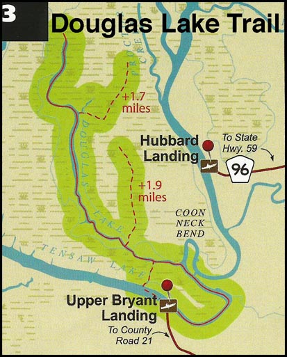
Ellis Landing is a spacious park and ramp across from Gees Bend proper, which lies to the north. Ellis Landing is a popular park and is near the southern landing of the ferry that serves people on the bend.
Gees Bend Park
Following upriver from Millers Ferry around the two great loops in the Alabama is the first Gees Bend landmark—Gees Bend Park and ramp on river left. The park also features a pavilion, playground, spacious meeting grounds and a toilet facility. Just beyond the park and almost adjacent to it by land is the Ferry Terminal Landing on the Gees Bend side. The terminal building is about a block off the water on the right, looking north.
Bridgeport Ramp
Bridgeport Ramp, adjacent to Bridgeport Beach, is a popular launch and day use area.
Bridgeport Beach
Bridgeport Beach is a local swimming and recreation area with substantial bath facilities adjacent to a very nice pavilion with tables. Sidewalks to the pavilion make it very accessible. All is situated just off a sandy beach on the river with a pier to serve it.
Tills Landing (through-paddlers only)
Between Elm Bluff Park and Six Mile campground there was no place to camp until landowner Woody Till allowed the Alabama Scenic River Trail to drive a campsite sign in the ground and put his contact information up as a Trail Angel (a helpful local who will go out of his or her way to assist paddlers). Called Till’s Landing (River Mile 183), this stopover for through-paddlers is too remote to serve as a point of access. In fact, we ask that you don’t even try. You would have to go though a number of farm fields to get to it, and that would violate our agreement with the landowner. If you need help, supplies, or a ride, call the number on the sign.
Six Mile Creek Campground
Six Mile Creek Campground is upriver 5.5 miles from Old Cahaba Archaeological Park, where Six Mile Creek enters the Alabama at Mile 194. Six Mile Creek Campground typically closes for the season after Labor Day. It’s a great place to stay near Selma. The campground has campsites with hookups, playgrounds, pavilions, and a washhouse with laundry are available.
Selma Marina
The Selma City Marina is undergoing a long reconstruction after a fire devastated the marina office, restaurant and store in 2010. The store is rebuilt and the restaurant is in operation, though large craft will find docking difficult in most conditions. Call the marina office at 334 874 2173. Gas for powerboaters is available there by appointment.
Steeles Landing
Steeles Landing features a picnic area and public boat launch. It is the last public park and launch before the community of Benton, and is situated on the top of Durant’s Bend.
Benton Park and Benton Ramp
At the mouth of Old Town Creek is the public ramp at Benton Park and the town of Benton. Benton was a highly developed and civilized community when rivers ruled the world of interstate transportation. Benton was an important riverboat, barge and stagecoach hub for the area.
During the Civil War, General Wilson—who had sacked and burned Selma and was now on his way to Montgomery to do the same—camped here. His battle-tested troops were held off from looting a house in Benton by the rifle-wielding women of the house.
Rules and regulations
Most of the facilities mentioned in this article and shown on the attending map are on properties operated by the US Army Corps of Engineers. A link to their Rules and Regulations follows. Consult the Contact Information provided for Rules and Regulations of other properties you might visit:
http://corpslakes.usace.army.mil/employees/visitassist/pdfs/title36-lrl.pdf
Universal Access Policies
It is the policy of the U.S. Army Corps of Engineers to provide universally accessible recreation opportunities for all people. The Corps will ensure that all new and existing facilities and programs meet or exceed current guidelines. Some existing facilities are continuing to be retro-fitted as funding allows.
Journey through the Locks of Time on the Alabama River Part I: Claiborne Lock and Dam to Millers Ferry Lock and Dam
Above: Detailed map of Claiborne Lake as it lies above Monroeville and below Camden. Click on the image to download a high-resolution PDF version for planning and printing.
The town of Claiborne could be the place referred to in the DeSoto Chronicles as Piache, but the death and devastation sewn by the diseases that DeSoto left in the wake of his travels may leave us never to know for sure. His army may have crossed the river here and marched to Choctaw Bluff. Or, he may have embarked upon the Tombigbee to make his encounter with Chief Tuscaloosa.
The now-dead town of Claiborne was established in 1813 by Andrew Jackson’s general of the same name who had in his army a number of Mississippi Choctaws friendly to the American cause and who fought bravely against the Red Stick rebels. The Mississippi Choctaw Indians were led by the famous Pushmataha. The American Revolutionary War hero the Marquis de LaFayette was entertained in the town at a lavish ball in 1825 on his post-revolution sweep of the country he helped to create. He was brought downriver from Montgomery aboard the Henderson, which sank at Claiborne upon its return trip.
Claiborne was once a river town connected to the Alabama River by a covered cotton slide and a 365-step staircase for pedestrian traffic. Today it is but a name on a map. Monroeville has become a literary Mecca because of the likes of Harper Lee and Truman Capote who were born there and went on to leave their marks on American writing. Today, there is plenty of literary-related activity for the Monroeville visitor including a visit to the Monroeville Courthouse where Lee’s “To Kill a Mockingbird” was filmed. The town puts on the play each April, the last scenes of which are acted out in the Courthouse where the movie, starring Gregory Peck, was filmed. Movie and book fans alike will be pleased with the “insider” connections to the movie making still kept throughout the town.
Naturalist Nugget: Below the dam, the river is open all the way to the Gulf of Mexico. Large fish, unable to travel further, can be found below the dam.
The Fort Mims Massacre and the Great Canoe Fight
On the twelfth of November of 1813, the world of the white settlers along the lower Alabama Rivers was on edge after the recent massacre downriver at Fort Mims where hundreds of men, women and children had been murdered in what would today be considered a terrorist attack. It sent up an alarm around the nation and across the world. After the attack, skittish settlers sent out scouting parties to determine the extent of Indian activity in the region. One such group had camped near Lovett’s Creek where it enters the Alabama River. There were three in the party, which included Sam Dale, the big frontiersman who was to the Alabama territory what Davy Crockett was to Tennessee; nineteen-year-old Jeremiah Austill; and a slave named Caesar. No sooner were they in the water that morning than Sam Dale looked upstream to see a dugout canoe with eleven Indians. The three paddled for the Indian craft, two of whose occupants left the canoe and swam for shore. The nine remaining Indians closed on the canoe of white settlers and joined them in battle.
In those days, canoes were used not in the seated position as we are accustomed to today, but were rowed by standing crew. We can but imagine the fight that took place as Caesar’s mighty grip held the two boats together as the occupants clubbed each other wildly with whatever they could find. The Indians perished in that bloody struggle, and their symbolic defeat at the hands of a smaller number of whites locked in hand-to-hand combat went down in history as the Great Canoe Fight.
The site of the Great Canoe Fight is south of Claiborne Dam at approximately mile 52 where Randon Creek and Lovett Creek enter the Alabama.
What is the black belt?
In hearing or reading about Alabama, you’ll often find references to the state’s Black Belt. Don’t feel bad if you’re not sure what it means. Many Alabamians can’t tell you either.
The term refers primarily to dense black topsoil over a layer of Selma chalk, a light limestone in a belt that stretches from Virginia to Texas. It covers the lower middle of Alabama. This land produced great quantities of cotton before it was worn out by exploitation, and is farmed very little in its current state. The Black Belt cotton grown in years past depended upon the Alabama and other related rivers to reach the cotton markets and shippers in Mobile and New Orleans.
Naturalist Nugget: The black belt is the prairie of Alabama, in a literal sense as well as a geological one. The land was scraped flat by glaciers in a previous ice age, and among the glaciers were open spots where plants and critters were pushed south to the black belt. Mitchell’s satyr butterfly, for instance, can be found only in certain spots in the black belt and areas of Minnesota and Michigan. The insect, one of the living things brought south with the glaciers, never left after they moved on.
Claiborne Lock and Dam
On Fridays and Saturdays, modern-day river passengers can visit the Alabama River Museum adjacent to the Claiborne Lock and Dam, March through October. Here you can view exhibits that will take you through a 60-million year trip from the geological formation of the area to the operation of the dams and its locks today. In between are represented Indian cultures (don’t miss the dugout log canoe suspended over your head) and steamboat days, including an exact replica of the Nettie Quill, queen of these waters, and actual artifacts rescued from the wrecks of these great vessels.
From Monroeville, take Highway 41 North 8 miles and turn left on County Road 17 and follow signs to the museum.
Lock schedules and information is available from the lockmaster at 251 282 4205. If paddlers arrive and need to pass the dam when the lock is not operating, or if you simply prefer to tote your boat, a takeout is available on the east bank within Isaac Creek at the campground boat ramp. The paved road will allow paddlers to portage past the lock and put in again below the dam at another U.S. Army Corps of Engineers boat ramp.
Isaac Creek Campground
Operated by the US Army Corps of Engineers, the campground offers full-service sites with concrete pads that can accommodate the biggest rigs with boats and toys in tow but are secluded and wooded to satisfy the primitive camper. Fishing must be good here if the number of boats are any indication.
Staying a while at a place like Isaac Creek Campground can sharpen one’s aptitude for leisure, and there’s a satisfying atmosphere about this quiet, remote stretch of the Alabama River.
Directions vary depending on where you are arriving from. For information, call the gatehouse at 251 282 4254.
The campground is expansive, well-kept and well planned. The amenities will accommodate anything from a fish camp to a fish fry.
Naturalist Nugget: Haines Island Park on the river’s east bank is connected with Davis Ferry Park on the west by the operation of Davis Ferry. Davis Ferry is operated by Monroe County and connects Haines Island Park with Packers Bend. The Big Leaf Magnolia Trail begins just a 500-foot walk from Haines Island Park. This short loop trail through a hardwood forest has signs identifying the plants located along the trail. There is a restroom and parking at the trailhead, where the Upper and Lower Ironwood Trails also begin. The park is home to the rare Red Hills salamander.
The 60-mile span of Claiborne Lake is provisioned for the camper with two full-service campgrounds: Isaac Creek Campground as mentioned above and Millers Ferry Campground upriver. Between the two full-service campgrounds are day use parks, which, with the exception of Hollys Ferry’s ability to serve as a paddler-only campground, do not allow camping. They are listed here in ascending order upriver:
- Silver Creek Park
- Haines Island Park/Davis Ferry Landing
- McDuffie Landing Park
- Bells Landing Park
- Lower Peachtree Park
- Black Creek Park
- Holleys Ferry Park
- Clifton Ferry Park
- Cobbs Landing Park
Most of the facilities mentioned in this article and shown on the attending map are on properties operated by the US Army Corps of Engineers. A link to their Rules and Regulations follows. Consult the Contact Information provided for Rules and Regulations of other properties you might visit:
http://corpslakes.usace.army.mil/employees/visitassist/pdfs/title36-lrl.pdf
It is the policy of the U.S. Army Corps of Engineers to provide universally accessible recreation opportunities for all people. The Corps will ensure that all new and existing facilities and programs meet or exceed current guidelines. Some existing facilities are continuing to be retro-fitted as funding allows.
Test site in progress
We’re testing some new things for the Alabama Scenic River Trail website. This page is simply a placeholder.
For information on the Alabama Scenic River Trail, please visit our normal URL – www.alabamascenicrivertrail.com